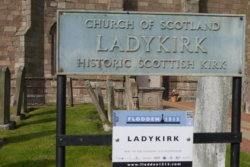
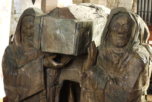
…or The Kirk of Our Lady of the Steill

Flodden 1513 Memorial

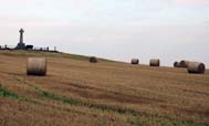
The parish of Ladykirk lies along the northern bank of the River Tweed, which separates Scotland from England, and is about half-way between Coldstream and Berwick. Norham Castle – the stronghold for the north of England – stands just across the river, whilst Haildon Hill and Flodden Field (two of the battles between nations) are just seven miles away (1333 and 1513 respectively).

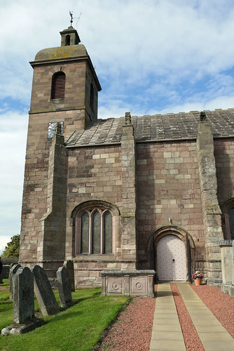
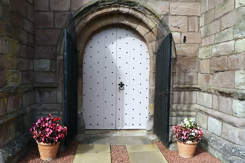
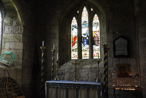
The Kirk of our Lady of the Steill (or, as it is now called, Ladykirk) originated during one of the many raids across the border, when, so the legend goes, King James IV of Scotland was nearly drowned crossing the ford which just below the church. He, it is claimed, vowed to build a church in memory of the Blessed Virgin of the Steill who had saved him. (A steill is a deep pool where salmon nets are placed.)His vow included the fact that the church should be one that could not be destroyed by either fire or flood (thus the very unusual stone roof), thinking, no doubt, of the many cross-border burning raids and the frequent floods of the Tweed valley.

When exactly this event took place we do not know, but it is known that James IV passed this way in 1496 and 1497. By 5th March 1500 the building had commenced and the work was entrusted to Sir Patrick Blackadder, and then in 1504 to George Ker. The stone used came from the Swinton Quarry (about 3 miles west), and the cost was about £1200 (£1 1/2 million in today’s prices). The king came often to see how the church was progressing – in 1501, twice in 1507 and before the ill-fated Flodden in 1513. He was present at a service in 1505 and gave 14/- as an offering. *

Ladykirk Church

Doorway

*Information from Church leaflet.

6 Comments CherryPie on Feb 1st 2014

The recent Google Doodle celebrating the 200th anniversary of the architect who renovated the walled city of Carcassonne brought back happy memories of my visit there in 2012.

From the Telegraph regarding the man and his anniversary:

Eugene Viollet-le-Duc, the architect known for his distinctive restoration work on medieval buildings, has been celebrated with a Google doodle.

The doodle depicts one of Viollet-le-Duc’s designs and celebrates what would have been his 200th birthday today.

Born in France, Viollet-le-Duc was involved in the July Revolution of 1830 and embraced republicanism and anti-clericalism.

The French theorist started restoring medieval buildings in 1835 and achieved national fame with his work at Notre Dame de Paris.

Viollet-le-Duc became known for the gothic elements of his designs and for combining historical fact with creative modifications, which led to criticism from his contemporaries and John Ruskin.

His works also included Basilica of St Denis near Paris, Carcassonne and Chateau de Pierrefonds.

As well as his work on restorations he was considered a theorist on modern architecture, making numerous drawings.

He had a second career in the military, defending Paris during the Franco-Prussian war from 1870 to 1871 and developing theories of defence that were to influence the engineers behind fortifications for both the first and second world wars.

Viollet-le-Duc later relocated to Switzerland where he built a villa, and remained there until his death in 1879.

From my archives:

Walled City

The walled city (La Cite) of Carcassonne was built on the site of a former Roman fortress.  The city is protected by two heavily fortified walls and has no less than 52 towers and barbicans. In medieval times Simon de Montfort led crusades against the Albigensians (Cathars) whom the Catholic Church had branded as heretics due to their beliefs.

At that time that city and its inhabitants were under the protection of Raymond Trencavel, “Vicomte de Carcassonne”. The town surrounding the city was destroyed during these crusades and King Louis IV authorised the building of the Bastide on the left bank of the river Aude as a replacement.

When the Roussillon region became part of France in 1659 the city’s strategic importance as a border fortress declined, the inhabitants moved to the lower town and the city fell into disrepair. In 1844 the architect Viollet-le-Duc was put in charge of the restoration of Saint-Nazaire and Saint-Celse basilica and subsequently he undertook a study of all the city fortifications. This study was used as a basis for the restoration of the city and its fortifications.

8 Comments CherryPie on Jan 30th 2014

Lindisfarne Castle

From Wiki:

Lindisfarne Castle is a 16th-century castle located on Holy Island, near Berwick-upon-Tweed, Northumberland, England, much altered by Sir Edwin Lutyens in 1901. The island is accessible from the mainland at low tide by means of a causeway.

The castle is located in what was once the very volatile border area between England and Scotland. Not only did the English and Scots fight, but the area was frequently attacked by Vikings. The castle was built in 1550, around the time that Lindisfarne Priory went out of use, and stones from the priory were used as building material. It is very small by the usual standards, and was more of a fort. The castle sits on the highest point of the island, a whinstone hill called Beblowe.

Lindisfarne’s position in the North Sea made it vulnerable to attack from Scots and Norsemen, and by Tudor times it was clear there was a need for a stronger fortification, although obviously, by this time, the Norsemen were no longer a danger. This resulted in the creation of the fort on Beblowe Crag between 1570 and 1572 which forms the basis of the present castle.

10 Comments CherryPie on Jan 29th 2014

The Journey

This sculpture stands inside The Parish Church of St Mary, Lindisfarne:

In the south aisle stands the imposing statue known as The Journey, depicting the monks of Lindisfarne carrying St.Cuthbert’s body on the first stage of its journey to Durham and is probably the first thing to catch the visitor’s eye. The sculpture is an acclaimed work of Dr Fenwick Lawson made up of 35 piece of elmwood, carved principally with a chain-saw. This has been loaned to St Mary’s Church and a bronze copy has been placed in the Millennium Square in Durham, thus marking the start and finishing places of the journey of St Cuthbert’s coffin between 698 and c920.

The Journey

14 Comments CherryPie on Jan 28th 2014

Keep your thoughts positive because your thoughts become your words.

Keep your words positive because you words become your behaviour.

Keep your behaviour positive because your behaviour become your habits.

Keep your habits positive because your habits become your values.

Keep your values positive because your values become your destiny.

Mahatma Gandhi

Life

19 Comments CherryPie on Jan 26th 2014

The Parish Church of St Mary

The Parish Church of St Mary
Stained Glass

9 Comments CherryPie on Jan 25th 2014

… Sacred knowledge of the Ancient Britains

Synopsis from (from book cover):

The huge stone circle built in the British Isles and northwest France from 6500 to 3500 years ago are among civilisation’s strangest monuments.  Ignored or plundered for centuries, they have only in modern times begun to reveal their remarkable complexity.

It is now widely acknowledged that these ancient sites were precisely aligned to major celestial events, probably lined to the agricultural calendar of early farming settlements.  But the mystery remains as to how the megalithic builders achieved such extraordinary accuracy in their measurements and construction.

Inspired by the surveying work of Alexander Thom, Anne Macaulay devoted her life to an investigation of the stone circle sites, seeking out their hidden geometry and deeper cultural significance.  In this book she draws on ideas from geometry and metrology, archaeology and anthropology, history and mythology, astronomy and music.

Macaulay concludes that the extraordinary mathematical skills of the ancient Britains were original and self-contained.  In turn, the elite of this society became the proto-Greeks, their knowledge flowing to the Eastern Mediterranean.

Review:

Anne Macaulay’s life work was collated by Vivian T. Linacre and Richard A. Batchelor and published posthumously.

The first part the book covers the geometry of megalithic rings throughout Great Britain and Northern France.  The measurements that Anne took are compared with the original measurements taken by Alexander Thom. Her work shows how the ancients had advanced mathematical knowledge and that the stone circles were measured out based on Fibonacci numbers.

In his works Thom proposed that two ancient measurements were used in the making of the megalithic rings; The Megalithic Yard and the Megalithic Rod.  Anne introduces I third measurement, The Greek Foot.  She further proposes that measuring sticks (ancient rulers) were used to measure out the sites and that this knowledge seemed to have died out after the megalithic era and was later rediscovered later by Leonardo of Pisa.

Anne thought that the transition from hunter gatherer to a settled farming community led to the requirement for astronomical and geometrical skills for forecasting the seasons and measuring boundaries and suggested that these skills were taken from Britain and the Atlantic to the Eastern Mediterranean.

It is a thoroughly fascinating book and I would recommend it to anyone who is interested in the subject.

4 Comments CherryPie on Jan 24th 2014

« Newer Posts - Older Posts »