From the BBC:

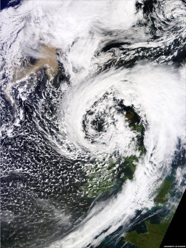
The ash cloud from the Icelandic volcanic eruption is captured on a satellite image as it approached the UK.

The pink-coloured drifting ash, in the top left of the picture, was taken by Nasa’s Terra satellite on Monday afternoon and has been published by Dundee University’s Satellite Receiving Station.

The white cloud sitting over north west Scotland is a low pressure system which has brought high winds and heavy rain to many areas of Britain.

The winds are coming from a north-westerly direction, blowing anti-clockwise round the low pressure system, drawing the ash plume from the volcano towards the northern half of Britain.

From Jon Gustafsson on 21st May 2011:

Haven’t really had time to watch the video. Volcano season keeps me pretty busy. I cut it on board the helicopter on the way back from the eruption. Threw some music from the fantastic composer Veigar Margeirsson (veigar.com) on it and posted it here.

It took us 90 minutes to fly to Grimsvotn with a strong wind against us. The eruption looked magnificent in the sunset. Once we landed 5 miles away from the crater the cold glacier air hit us like a truck. We tried to work outside but I only lasted for a couple of minutes. Pilot Reynir Petursson also didn’t want to stay on the ground for too long since it was very windy and the ash fall was unpredictable. The light was also disappearing and he needs visual reference which is difficult on a white glacier. Once we got off the ground again we had to stay low because there were so many lightnings all around the eruption. Getting hit by a lightning in that strong wind, extreme frost and next to a live volcano was not desirable. We made it back to Reykjavik at 2am. Now the airspace has been closed in a 20 nautical miles radius because of ash.

Volcanic Eruption in Grimsvotn, Iceland May 21 2011 from Jon Gustafsson on Vimeo.

12 Comments CherryPie on May 24th 2011

100photos2

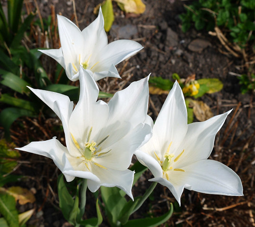
In Fields of Blue

10 Comments CherryPie on May 23rd 2011

Thinking doesn’t pay.  Just makes you discontented with what you see around you.

Robert A. Heinlein

Thirds

18 Comments CherryPie on May 22nd 2011

… and you took me in.

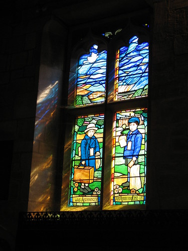
This is a window from All Saints Church that can be found within the grounds of Sudbury Hall.  A plaque in front of the window gives the following information:

When war was declared in 1939, Manchester like many other cities moved fast to protect its young; living in and near to the city centre.  Children were uprooted from the security of their homes, marched in columns to the railway stations and re-housed in selected locations within the countryside.   One such location was Sudbury, Derbyshire, which catered for the children of St Thomas’ School, Ardwick, Manchester.

Now some 60 years later, this historic event has finally been recorded for all time by the instillation of a specially designed stained glass window; handmade by Michael Stokes.  The window was commissioned by a small group of evacuees and presented to the community in the first year of the Millennium as an expression or their gratitude and thanks for the protection and affection, the experienced during the war years.

The Bishop of Derby dedicated the window at a special service on 3rd June 2001.

I Was a Stranger

6 Comments CherryPie on May 21st 2011

photohunt

This photo is just perfect for the theme so I make no apologies for having posted it before ;-)

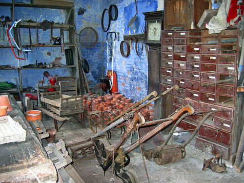
This is one of the garden buildings showing how things accumulate.  It doesn’t bear thinking about the house does it ;-)

Calke Abbey

For more of this weeks PhotoHunt pictures check out tnchick.

20 Comments CherryPie on May 21st 2011

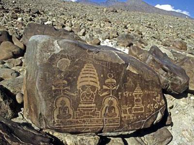
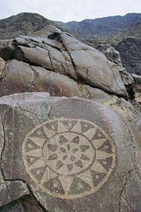
DailyIndia reports that the proposed sight of the Basha-Diamer Dam in Pakistan, holds thousands of ancient rock carvings and inscriptions. If the construction of the dam goes ahead around 30,000 carvings on 5,000 rocks would be affected. Some would be totally submerged and some would be seasonably visible when water levels were low.

Professor Harald Hauptmann, head of a research project entitled “Rock Carvings and Inscriptions along the Karakorum Highway”, told Dawn.com that a total of 37,051 carvings on 5,928 boulders or rock faces would be inundated after the construction of the Diamer-Basha Dam.

The site hosts hundreds of inscriptions in Brahmi, Sogdian, middle Persian, Chinese, Tibetan and Hebrew languages. Some 80 per cent of the writings are in Brahmi language.

These writings not only provide insights into the religious and political situation but also show the name of the rulers and a rough date of the time. The earliest rock carvings in northern Pakistan dates back to the ninth millennium BC (roughly late Stone Age).

When asked about the importance of the rock carvings in one hand and the need of the dam on the other, Hauptmann said: “We (as an archaeologist) have to respect the decision (to build the dam), but it is very sad for us to lose one of the most rich and diverse rock art provinces of the world.”

According to Hauptmann, the Basha Dam will drown 32 villages and displace more than 25,000 people, and some 3,000 very important stupas and a similar number of drawings will be submerged after the construction of the dam.

The World Monuments Fund gives further background on the petroglyphs:

Meandering through gorges of the Indus River valley and across high mountain passes, ancient arteries of the fabled Silk Road cut through the Diamer District of Northern Pakistan. Along these pathways, thousands of petroglyphs cover cliffs, rock faces, and boulders, standing testament to the ancient cultures that once settled in this region and the merchants, pilgrims, and conquerors who later journeyed through it. Over 50,000 rock carvings and 5,000 inscriptions serve as a timeline from the Epipaleolithic period to the pre-Islamic “golden era” of Buddhism. The earliest petroglyphs, which depict wild animals such as ibex and sheep, were created by groups of hunter-gathers first drawn to the region in the early Holocene. By the first millennium B.C., Scytho-Saka tribal groups from Central Asia had introduced the Eurasian animal style of drawing. As this region developed into a dynamic Himalayan crossroads in the Silk Road era, more petroglyphs exhibited Buddhist iconography and architectural forms, most importantly associated with the building of stupas.

The full DailyIndia article can be viewed here and more information on the World Monuments Fund action plan can be found here.

Photos from the World Monuments Fund website.

17 Comments CherryPie on May 20th 2011

I managed to lose 1lb this week, although I feel as if I have lost a bit more…

Weight Loss - Week 42

6 Comments CherryPie on May 19th 2011

« Newer Posts - Older Posts »